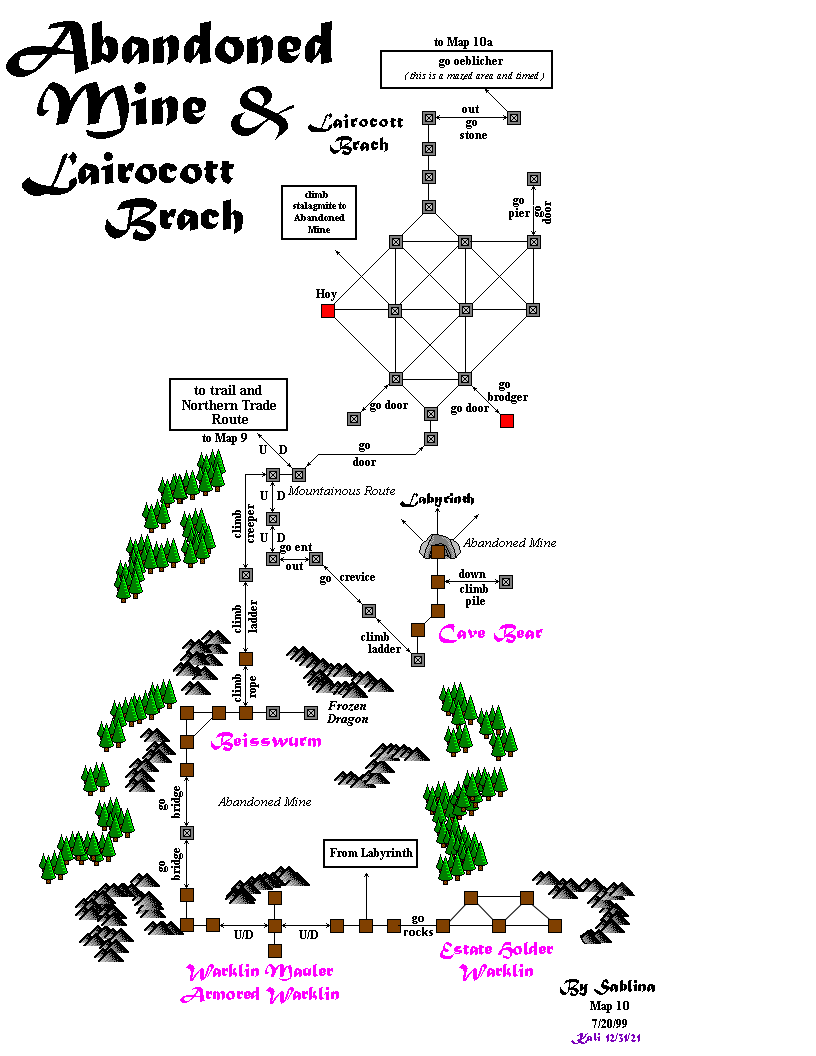
RanikMap10: Difference between revisions
Jump to navigation
Jump to search
(added map key) |
FREEDOMMINE (talk | contribs) No edit summary |
||
| (3 intermediate revisions by 3 users not shown) | |||
| Line 1: | Line 1: | ||
<imagemap> |
<imagemap> |
||
Image: |
Image:Zoluren, 10, Stone Clan.png |
||
rect 140 350 300 445 [[RanikMap9]] |
rect 140 350 300 445 [[RanikMap9]] |
||
rect 367 32 563 97 [[RanikMap10a]] |
rect 367 32 563 97 [[RanikMap10a]] |
||
| Line 6: | Line 6: | ||
</imagemap> |
</imagemap> |
||
{| |
|||
{{Map infobox |
|||
|description=Abandoned Mine + Lairocott Brach |
|description=Abandoned Mine + Lairocott Brach |
||
|province= Zoluren |
|province= Zoluren |
||
| Line 16: | Line 16: | ||
|shops= *[[Muckele's Hoy]] |
|shops= *[[Muckele's Hoy]] |
||
*[[Forkbeard's Brodger]] |
*[[Forkbeard's Brodger]] |
||
|landmarks=[[Oeblicher]] |
|landmarks=*[[Oeblicher]] |
||
|people= |
|people= |
||
|relatedmaps= |
|relatedmaps= |
||
}} |
}} |
||
| valign=top | {{RanikMapKey}} |
|||
|} |
|||
==Notes== |
==Notes== |
||
Latest revision as of 00:05, 31 December 2021

|
| ||||||||||||||||||||||||||||||||||||||||||||