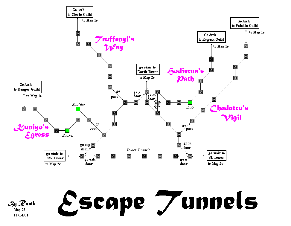
RanikMap2d: Difference between revisions
Jump to navigation
Jump to search
(Converted to Wiki ImageMap) |
No edit summary |
||
| (5 intermediate revisions by one other user not shown) | |||
| Line 4: | Line 4: | ||
rect 136 492 225 559 [[RanikMap2c]] |
rect 136 492 225 559 [[RanikMap2c]] |
||
rect 682 492 766 557 [[RanikMap2c]] |
rect 682 492 766 557 [[RanikMap2c]] |
||
rect 39 285 137 307 [[RanikMap1e]] |
|||
rect 223 33 311 55 [[RanikMap1e]] |
|||
rect 660 123 753 141 [[RanikMap1e]] |
|||
rect 770 75 866 96 [[RanikMap1e]] |
|||
desc none |
desc none |
||
</imagemap> |
</imagemap> |
||
{{Map infobox |
|||
Map2d is in the [[Zoluren]] province.<br/> |
|||
|description=Crossing Temple: Escape Tunnels |
|||
It has 0 shops: <br/> |
|||
|province= Zoluren |
|||
Notable People: <br/> |
|||
|landmarks= |
|||
Landmarks worthy of their own entry:<br/><br/> |
|||
|relatedmaps= |
|||
}} |
|||
Other Notes: |
|||
==Notes== |
|||
<br/> |
|||
Truffenyi Way and Kuniyo Egress labels should be swapped. |
|||
<br/> |
|||
Return to [[Ranik Maps]][[Category:Ranik Maps]] |
|||
Latest revision as of 22:39, 28 January 2009

|
| ||||||||||||||||||||||||||||||||||||||||||||