File:Map90.gif
Jump to navigation
Jump to search
Size of this preview: 540 × 600 pixels. Other resolution: 951 × 1,056 pixels.
Original file (951 × 1,056 pixels, file size: 36 KB, MIME type: image/gif)
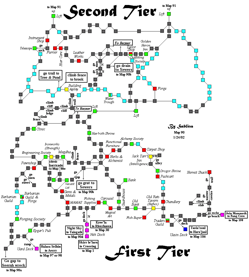
First and Second Tiers of Ratha
Ranik Map
File history
Click on a date/time to view the file as it appeared at that time.
| Date/Time | Thumbnail | Dimensions | User | Comment | |
|---|---|---|---|---|---|
| current | 01:32, 14 June 2017 | | 951 × 1,056 (36 KB) | GNIKOLEYCHUK (talk | contribs) | Added even more missing housing areas |
| 01:20, 14 June 2017 |  | 951 × 1,056 (36 KB) | GNIKOLEYCHUK (talk | contribs) | Added housing on Upper Cobra Road/Koradu Avenue | |
| 12:09, 16 September 2016 |  | 951 × 1,056 (36 KB) | DAEMETHEUS (talk | contribs) | added Forging and Outfitting society locations | |
| 17:04, 12 September 2016 |  | 951 × 1,056 (36 KB) | DAEMETHEUS (talk | contribs) | Reverted to version as of 17:00, 12 September 2016 (CDT) | |
| 17:03, 12 September 2016 |  | 951 × 1,056 (36 KB) | DAEMETHEUS (talk | contribs) | last uploaded changes didn't take | |
| 17:00, 12 September 2016 |  | 951 × 1,056 (36 KB) | DAEMETHEUS (talk | contribs) | added Engineering and Alchemy society locations | |
| 16:07, 7 February 2014 |  | 951 × 1,056 (36 KB) | Maintenance script (talk | contribs) | Importing image file |
You cannot overwrite this file.
File usage
The following page uses this file: