File:Map40a.gif
Jump to navigation
Jump to search
Size of this preview: 798 × 600 pixels. Other resolution: 977 × 734 pixels.
Original file (977 × 734 pixels, file size: 104 KB, MIME type: image/gif)
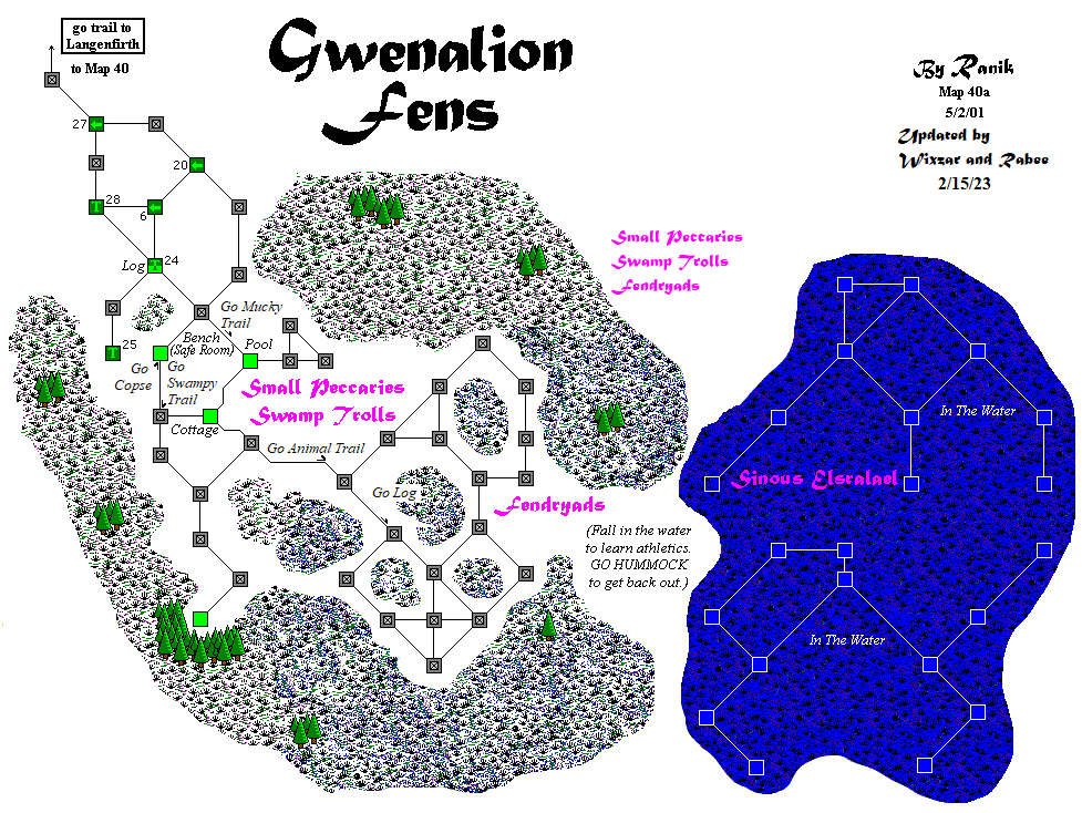
Fendryads in Langenfirth
Ranik Map
File history
Click on a date/time to view the file as it appeared at that time.
| Date/Time | Thumbnail | Dimensions | User | Comment | |
|---|---|---|---|---|---|
| current | 15:22, 15 February 2023 | | 977 × 734 (104 KB) | RABB (talk | contribs) | |
| 15:21, 15 February 2023 |  | 977 × 734 (104 KB) | RABB (talk | contribs) | Reverted to version as of 14:19, 15 February 2023 (CST) | |
| 15:20, 15 February 2023 |  | 977 × 734 (104 KB) | RABB (talk | contribs) | ||
| 15:19, 15 February 2023 |  | 977 × 734 (104 KB) | RABB (talk | contribs) | ||
| 01:54, 9 November 2016 |  | 977 × 734 (113 KB) | HRODBERACHT (talk | contribs) | ||
| 16:06, 7 February 2014 |  | 977 × 734 (34 KB) | Maintenance script (talk | contribs) | Importing image file |
You cannot overwrite this file.
File usage
The following page uses this file: