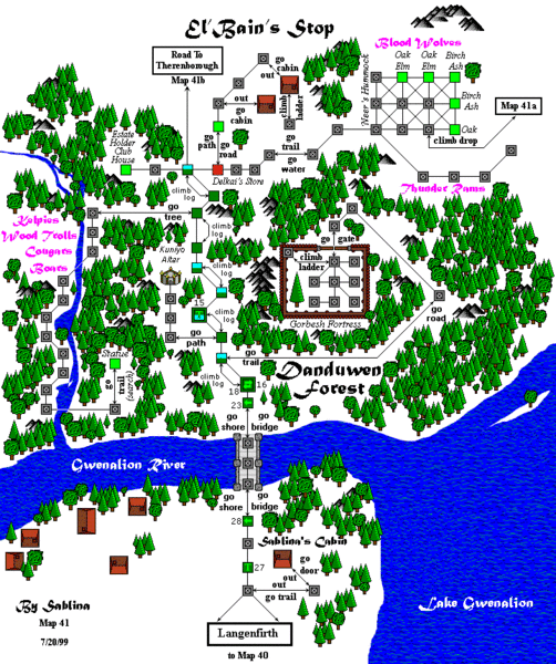
File:Map41.gif
Jump to navigation
Jump to search

Size of this preview: 502 × 600 pixels. Other resolution: 720 × 860 pixels.
Original file (720 × 860 pixels, file size: 105 KB, MIME type: image/gif)
The road from Lang to Theren
Ranik Map
File history
Click on a date/time to view the file as it appeared at that time.
| Date/Time | Thumbnail | Dimensions | User | Comment | |
|---|---|---|---|---|---|
| current | 01:25, 9 November 2016 |  | 720 × 860 (105 KB) | HRODBERACHT (talk | contribs) | fixing ranger trails, basic geography |
| 10:52, 14 June 2015 |  | 660 × 860 (28 KB) | LOREALI6 (talk | contribs) | {{Ranik Map}} | |
| 10:52, 14 June 2015 | No thumbnail | 660 × 860 (28 KB) | LOREALI6 (talk | contribs) | {{Ranik Map}} | |
| 15:06, 7 February 2014 |  | 660 × 860 (26 KB) | Maintenance script (talk | contribs) | Importing image file |
You cannot overwrite this file.
File usage
The following page uses this file: