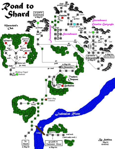
File:Map64.gif
Jump to navigation
Jump to search

Size of this preview: 463 × 599 pixels. Other resolution: 816 × 1,056 pixels.
Original file (816 × 1,056 pixels, file size: 58 KB, MIME type: image/gif)
STR From the Gondola
Ranik Map
File history
Click on a date/time to view the file as it appeared at that time.
| Date/Time | Thumbnail | Dimensions | User | Comment | |
|---|---|---|---|---|---|
| current | 19:29, 13 June 2017 | | 816 × 1,056 (58 KB) | GNIKOLEYCHUK (talk | contribs) | Marked housing area in Periel's Mere |
| 03:29, 14 June 2015 |  | 816 × 1,056 (58 KB) | LOREALI6 (talk | contribs) | {{Ranik Map}} | |
| 05:45, 17 July 2014 |  | 816 × 1,056 (55 KB) | ABSOLON (talk | contribs) |
You cannot overwrite this file.
File usage
There are no pages that use this file.